
About the Branch
Summary of Branch Area
 The Westmorland Branch of CAMRA covers the whole of the old county of Westmorland, along with the Sedbergh Rural District area that moved from Yorkshire to Cumbria in 1974, and a small portion of Cumberland to the north of Ullswater. Basically it is the south eastern third of Cumbria, stretching from Langdale in the West, Eamont Bridge in the North, Brough in the East and Milnthorpe in the South. It includes parts of two national parks within its boundaries, namely the Lake District National Park and the Yorkshire Dales National Park.
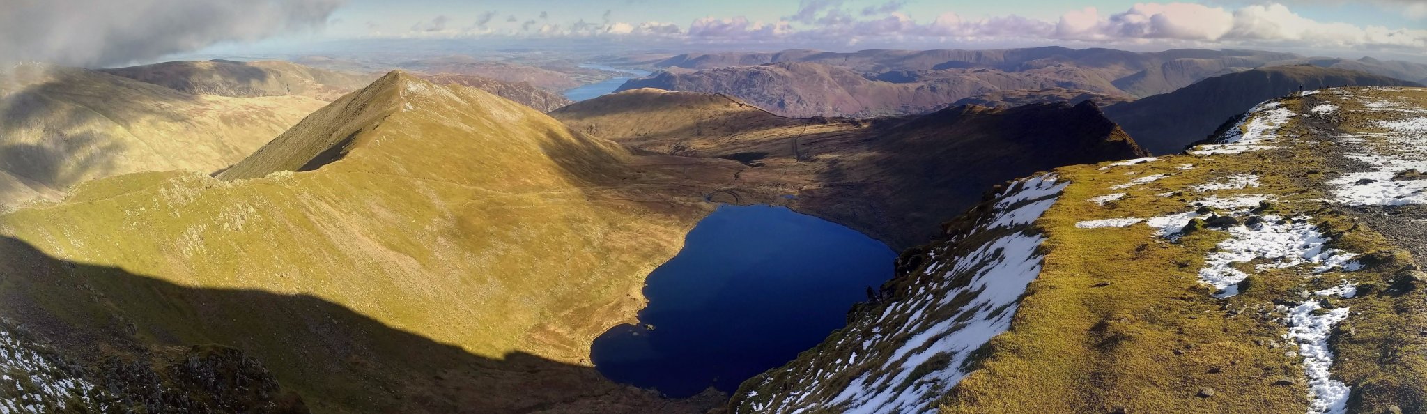
The highest point of the branch is the summit of Helvellyn which at 950m (3,117 feet) is the third highest mountain in England. The branch also contains or shares the summits of many other notiable mountains including Crinkle Crags, Bowfell, Helm Crag, High Street, Fairfield and Whernside. Added to this are several of the Lake District lakes and tarns, the largest of which are Windermere, Ullswater and Haweswater. The branch covers a large area of approximately 2,378 square kilometres (918 square miles) which is just over a third of Cumbria, and slightly smaller than the country of Luxembourg.
Following the council changes of April 2023, the branch area is now within the Westmorland and Furness unitary authority area.
In addition to the national parks, the branch also includes parts of the Arnside and Silverdale and North Pennines Areas of Outstanding natural beauty, and the main industries are tourism and farming. The major population centres are Kendal, Appleby-in-Westmorland, Kirkby Stephen, Windermere and Ambleside. The estimated population of the branch for 2018 is 94,946.
In terms of beer, at the last count there were 411 licensed premises within the branch area of which 213 were known to be serving real ale. There are currently 12 breweries believed to be brewing within the branch.
More details on the branch demographics can be found on the Branch Demographics page.
A rough map of the branch area should be available here.
Public Transport
For an overview of the Public Transport options within the branch, please see the following. Note that these pages will become out of date over time.